Introduction to morphology of the Italian peninsula
1. Position and shape
The diverse and exquisite nature of the Geography of Italy accounts for its attractiveness which has made the country a popular travelers’ destination.
The country is basically a peninsula with a unique boot shape, extending into the blue waters of the Mediterranean. Surrounded by seas on all three sides, Italy possesses a distinct beauty of its own.
2. Seas
The geographical features of Italy are varied; the south-western corner of the country is enveloped by Tyrrhenian Sea, while Adriatic Sea takes care of its north-eastern parts. The south-eastern Ionian Sea and the Ligurian Sea located in north-west Italy encircle the country from al possible sides and act as a shield of safety for Italy.
3. Mountains
The geography of Italy has two mountain ranges, namely the Alps and the Apennines. The Apennine mountain range is the literal backbone of the country, surrounding the north-western parts, from where it goes to join the Alps.
The natural position of both these mountain ranges acquires the shape of an arc and this semicircular topography strengthens the northern boundaries of Italy which in the past made difficult any possible foreign invasions.
Mont Blanc, popularly known as Monte Bianco, 4810 meters above sea levels, is the highest Italian mountain summit.
4. Volcanoes
The land also has two reputed volcanoes, among which Mount Vesuvius (1,281 m) close to Naples is presently in a dormant state. The other volcanic peak in Sicily, Mount Etna (3,326 m) is still very active, that seldom poses threat to the inhabitants of Italy.
Next to the mountains and the seas, come the valleys and the plain lands in the Geography of Italy
5. Rivers
Italian rivers consist of a diversity of fluvial ecosystem ranging from Alpine glaciers-fed brooks and artificial canals. They all flow through densely populated areas.
Italian rivers are shorter than most other European rivers because of the shape of the Italian peninsula and of the Appennines that separate runoff along two opposites slopes in peninsular Italy.
In continental Italy, streams generally have relatively high discharge because of abundant rainfall and runoff from Alpine snowfields and glaciers.
The different geographic, morphological and climatic settings of the area determine only different stream types, but also different kinds of land use, and the degree of urbanization, pollution and impacts on water resources.
Although Italy is rich in water resources, the distribution is uneven, with the majority occurring in north 65%, 15% in the center, 12% in the south, and 8% in the main islands.
6. Po and Alpine rivers
Because of this variability, our primary focus is the Po river, the longest river of Italy (652 km) which forms the largest Italian plain and covers 24% of Italy.
Padan Plain is drained by the Po and its numerous tributaries and distributaries, mostly flowing down from the Alps and Apennines to join it. Some of the tributaries of Po River like Mincio, Dora Baltea, Trebbia and Secchia bring in extensive alluvial deposits on the plain, increasing its fertility and making it appropriate for cultivation.
Italy currently has a population of about 60.000.000 inhabitants with density of 200 inhabitans per km2. Over 16 million people live within the Po river basin encompasses 3188 municipalities.
Other Alpine rivers include the Adige, the 2nd longest Italian river and the Tagliamento because of its relatively pristine condition.
The Brenta river also was included because of its historical role in the region and as an example of a river with a mix of natural and artificially regulated reaches.
7. Peninsular rivers
The two slopes of the central Appennines east towards the Adriatic sea and west towards the Tirrenian sea are strongly asymmetrical.
The western rivers are longer, more branched and flow in meandring valleys, whereas Eastern rivers that flow into the Adriatic sea have steep slopes, almost linear courses, few tributaries and are shorter than 100 km.
The chief peninsular rivers are the Arno and the Tiber. From its sources in the Apennines
The Arno flows west for about 240 km (about 150 mi), through a well-cultivated valley and the cities of Florence and Pisa.
The Tiber rises not far from the sources of the Arno and runs through the city of Rome
The Tiber and Arno rivers, two major Italian rivers, are good examples of central Appenine rivers that flow to the Tirrenian sea.
The Sangro in Campania was include as an example of a river flowing from the Adriatic Appennine slope.
Some other notable Italian rivers include:
Piave
Reno
Volturno
Isonzo
From the many interesting streams in the southern appennines, the Amendolea in Calabria was included as a typical ephemeral stream called “fiumara”.
Last, representative rivers from the two main Mediterrenean island are also presented: the Flumendosa in Sardinia, and the Alcantara and Simeto in Sicily.
The rivers of the Italian Peninsula are shallow, often dry during the summer season, and consequently of little importance for navigation or industry
These rivers illustrate the complex array of Italian river ecosystems, although we are aware that several minor typologies tha we have omitted.
8. Lakes
Italy is also a land of lakes. The largest lake in Italy – Lake Garda covers a land area of 370 km². Mention may be made of some other lakes in the country too like:
Northern Italy
Lake Como
Lake Iseo
Lake Maggiore
Central Italy
Lake Bolsena
Lake Bracciano
Lake Trasimeno
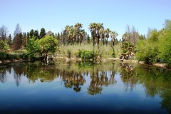
All these fresh water lakes add to the scenic beauty of the land, making it more and more alluring to international tourists


![Rain.2 [Francesca Boscarino] Rain.2 [Francesca Boscarino]](https://live.staticflickr.com/7039/6973225399_0d584019ef_m.jpg)
![waves. [Domiziana Casuccio]* waves. [Domiziana Casuccio]*](https://live.staticflickr.com/7188/6956657225_fdcb9d652e_m.jpg)
![beach.[Domiziana Casuccio]* beach.[Domiziana Casuccio]*](https://live.staticflickr.com/7044/6956656941_a192fed601_m.jpg)
![Rough Sea. [Domiziana Casuccio]* Rough Sea. [Domiziana Casuccio]*](https://live.staticflickr.com/7056/6810544746_f5a2135c8c_m.jpg)
![Clear sea. [Domiziana Casuccio]* Clear sea. [Domiziana Casuccio]*](https://live.staticflickr.com/7177/6956650891_f76dc73a82_m.jpg)
![Rough Sea 2. [Domiziana Casuccio]* Rough Sea 2. [Domiziana Casuccio]*](https://live.staticflickr.com/7040/6810538520_b6cbf362ab_m.jpg)
![Cliff. [Domiziana Casuccio]* Cliff. [Domiziana Casuccio]*](https://live.staticflickr.com/7208/6810535158_b1aa45308e_m.jpg)