Little Droplette’s Adventure: a story about water

to read it click on this link : http://www.storyjumper.com/book/index/9176072/Little-Droplette-s-Adventure

to read it click on this link : http://www.storyjumper.com/book/index/9176072/Little-Droplette-s-Adventure

Aurora and Giulia

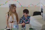
Microscope

Enrico e Giuseppe

Water drop

in the lab

observation

Carlotta e Martina

Microscope lens

pipette

lens

Martina


beaker


Martina and Gianmarco

Carlotta
Water, primordial element and source of life, will find ample space in the development of Italian literature. For you today we have chosen the poem “Clear, fresh and sweet waters” by Francesco Petrarca as an example of water considered as an inspiring muse of comforting memory of the beloved woman.
This is a presentation about the chemical composition of the water molecule. With it the students dealt with different aspects of water, for example with history of Science, talking about Cavendish and his experiment. And in Chemistry we analized the special structure of water molecule. (Click on the title link to viualize our Prezi presentation)


DIARIO de FERROL Viernes, 16 de Marzo de 2012
[Traduzione dell’articolo pubblicato sul “Diario de Ferrol” quotidiano della stampa locale della cittadina spagnola, dove la delegazione della nostra scuola formata dalla Dirigente scolastica Prof.ssa Castorina, dalla prof.ssa Brunno, coordinatore del progetto e 6 alunni: Maria Chiara Castorina, Giorgia Damiata, Valentina Fortuna, Noemi Giangreco, Carlotta Passanisi, Vito Pantaleo, è stata ospitata dal 14 al 18 Marzo 2012 per il secondo meeting del Partenariato multilaterale LLP Comenius “Water: the Spring of Life“]
Il IES Concepción Arenal accoglie una riunione del progetto europeo Comenius
Il programma Comenius è volto a rafforzare la dimensione europea nel campo dell’istruzione, promuovendo la mobilità e la cooperazione tra scuole.
Consapevoli delle potenzialità che questo tipo di piano offre, l’istituto Concepciòn Arenal IES di Ferrol ha intrapreso, quest’anno, il suo terzo progetto europeo, in questo caso con l'”acqua” come argomento principale del lavoro da sviluppare nell’arco di due anni scolastici.
Con più di 40 alunni e 15 insegnanti al lavoro presso il centro di Ferrol, il progetto coinvolge altre scuole di altri paesi come l’Italia, Estonia, Francia e Turchia. Una delegazione di tutti loro, composta da 17 alunni di età compresa tra 12 e 18, e 11 insegnanti rimarrà per quattro giorni, da ieri a Domenica, nella città navale per andare avanti con il progetto, ma anche per far vivere e condividere Ferrol ai studenti e docenti stranieri attraverso le esperienze con i loro coetanei spagnoli.
Il programma previsto in questi giorni è iniziato ieri mattina con una giornata di presentazione presso lo stesso istituto che. con gli studenti del centro ha organizzato, spettacoli vari, musica, teatro e magia. La sessione ha dato anche modo di svolgere il primo dei workshops, in cui i ragazzi dei diversi paesi hanno relazionato sul lavoro svolto finora.
Tra questi, un’esposizione geografica sull’idrografia di ogni paese, la progettazione di loghi diversi da cui se ne sceglierà uno per identificare il progetto europeo e un glossario di termini relativi all’acqua.
Domani si terrà una sessione di lavoro per decidere le attività da sviluppare prima del terzo incontro, che si svolgerà in Italia tra due mesi. Tra le proposte che sono già previste e per cui il lavoro è già iniziato c’è l’impostazione di un questionario/sondaggio on line sul consumo corretto dell’acqua con domande proposte dalle scuole partner.
Il Professor Miguel Pérez Fontela della IES Concepción Arenal, coordinatore del progetto, ieri, ha sottolineato l’importanza di favorire l’integrazione tra studenti di paesi diversi, e quindi anche culture diverse, “per creare l’Europa” ha detto.
Bisogna aggiungere che in questi giorni, gli studenti comunicheranno tra loro in inglese, promuovendo in tal modo le competenze linguistiche nella lingua in cui si svilupperà tutto il lavoro.
Accrescere la consapevolezza dell’acqua all’interno delle comunità scolastiche, sostenere l’importanza dell’acqua, incoraggiare i giovani a trascorrere più tempo a contatto con la natura, la conoscenza delle piante e degli animali degli ecosistemi acquatici del territorio che saranno oggetto di studio attraverso attività pratiche, migliorare le competenze informatiche e di comunicazione degli studenti sono alcuni degli obiettivi contemplati dal programma.
Il soggiorno nella città navale, è impostato su un intenso programma di attività che, ieri, tra le altre cose, ha incluso un ricevimento al Palazzo di Città del Comune di Ferrol e ha offerto una passeggiata lungo il fiume Belelle nel pomeriggio.
Per oggi è previsto il giro del porto a bordo di una nave della Marina militare e nella giornata di sabato visite mattutine per le città di La Coruña e Santiago. Domenica le delegazioni straniere torneranno nei loro paesi lasciandosi con lo “sguardo” al prossimo meeting in Sicilia in maggio.
[traduzione Prof.ssa Brunno]

Interactive Poster on the watercycle created by Valentina Fortuna 3B SPP after a CLIL lesson of Science in English

Questo video è stato realizzato da Giorgia Spinali, della classe I A r, dopo aver rielaborato in un lavoro di gruppo, guidato dalla prof.ssa Lipari Zaira, i miti e le leggende sull’acqua della nostra tradizione legate al nostro territorio.
Introduction to morphology of the Italian peninsula
1. Position and shape
The diverse and exquisite nature of the Geography of Italy accounts for its attractiveness which has made the country a popular travelers’ destination.
The country is basically a peninsula with a unique boot shape, extending into the blue waters of the Mediterranean. Surrounded by seas on all three sides, Italy possesses a distinct beauty of its own.
2. Seas
The geographical features of Italy are varied; the south-western corner of the country is enveloped by Tyrrhenian Sea, while Adriatic Sea takes care of its north-eastern parts. The south-eastern Ionian Sea and the Ligurian Sea located in north-west Italy encircle the country from al possible sides and act as a shield of safety for Italy.
3. Mountains
The geography of Italy has two mountain ranges, namely the Alps and the Apennines. The Apennine mountain range is the literal backbone of the country, surrounding the north-western parts, from where it goes to join the Alps.
The natural position of both these mountain ranges acquires the shape of an arc and this semicircular topography strengthens the northern boundaries of Italy which in the past made difficult any possible foreign invasions.
Mont Blanc, popularly known as Monte Bianco, 4810 meters above sea levels, is the highest Italian mountain summit.
4. Volcanoes
The land also has two reputed volcanoes, among which Mount Vesuvius (1,281 m) close to Naples is presently in a dormant state. The other volcanic peak in Sicily, Mount Etna (3,326 m) is still very active, that seldom poses threat to the inhabitants of Italy.
Next to the mountains and the seas, come the valleys and the plain lands in the Geography of Italy
5. Rivers
Italian rivers consist of a diversity of fluvial ecosystem ranging from Alpine glaciers-fed brooks and artificial canals. They all flow through densely populated areas.
Italian rivers are shorter than most other European rivers because of the shape of the Italian peninsula and of the Appennines that separate runoff along two opposites slopes in peninsular Italy.
In continental Italy, streams generally have relatively high discharge because of abundant rainfall and runoff from Alpine snowfields and glaciers.
The different geographic, morphological and climatic settings of the area determine only different stream types, but also different kinds of land use, and the degree of urbanization, pollution and impacts on water resources.
Although Italy is rich in water resources, the distribution is uneven, with the majority occurring in north 65%, 15% in the center, 12% in the south, and 8% in the main islands.
6. Po and Alpine rivers
Because of this variability, our primary focus is the Po river, the longest river of Italy (652 km) which forms the largest Italian plain and covers 24% of Italy.
Padan Plain is drained by the Po and its numerous tributaries and distributaries, mostly flowing down from the Alps and Apennines to join it. Some of the tributaries of Po River like Mincio, Dora Baltea, Trebbia and Secchia bring in extensive alluvial deposits on the plain, increasing its fertility and making it appropriate for cultivation.
Italy currently has a population of about 60.000.000 inhabitants with density of 200 inhabitans per km2. Over 16 million people live within the Po river basin encompasses 3188 municipalities.
Other Alpine rivers include the Adige, the 2nd longest Italian river and the Tagliamento because of its relatively pristine condition.
The Brenta river also was included because of its historical role in the region and as an example of a river with a mix of natural and artificially regulated reaches.
7. Peninsular rivers
The two slopes of the central Appennines east towards the Adriatic sea and west towards the Tirrenian sea are strongly asymmetrical.
The western rivers are longer, more branched and flow in meandring valleys, whereas Eastern rivers that flow into the Adriatic sea have steep slopes, almost linear courses, few tributaries and are shorter than 100 km.
The chief peninsular rivers are the Arno and the Tiber. From its sources in the Apennines
The Arno flows west for about 240 km (about 150 mi), through a well-cultivated valley and the cities of Florence and Pisa.
The Tiber rises not far from the sources of the Arno and runs through the city of Rome
The Tiber and Arno rivers, two major Italian rivers, are good examples of central Appenine rivers that flow to the Tirrenian sea.
The Sangro in Campania was include as an example of a river flowing from the Adriatic Appennine slope.
Some other notable Italian rivers include:
Piave
Reno
Volturno
Isonzo
From the many interesting streams in the southern appennines, the Amendolea in Calabria was included as a typical ephemeral stream called “fiumara”.
Last, representative rivers from the two main Mediterrenean island are also presented: the Flumendosa in Sardinia, and the Alcantara and Simeto in Sicily.
The rivers of the Italian Peninsula are shallow, often dry during the summer season, and consequently of little importance for navigation or industry
These rivers illustrate the complex array of Italian river ecosystems, although we are aware that several minor typologies tha we have omitted.
8. Lakes
Italy is also a land of lakes. The largest lake in Italy – Lake Garda covers a land area of 370 km². Mention may be made of some other lakes in the country too like:
Northern Italy
Lake Como
Lake Iseo
Lake Maggiore
Central Italy
Lake Bolsena
Lake Bracciano
Lake Trasimeno
All these fresh water lakes add to the scenic beauty of the land, making it more and more alluring to international tourists
Giorno 16 febbraio la nostra classe è stata coinvolta in un gioco di ruolo in inglese. La classe è stata divisa in due gruppi: la popolazione delle Dry Lands e quella delle Wet Lands. I due gruppi hanno preparato un dibattito sulla costruzione di una diga e sulle sue conseguenze, positive e negative. I gruppi hanno sostenuto il dibattito animatamente, e alla fine hanno accresciuto le loro capacità nel parlare in inglese.
Le tracce da seguire erano:
“Dry Lands: your country has a water shortage even though there is a big river (The Swift) running through your country. One suggestion is to build a dam and create a man-made lake. However, if you do this your neighbouring country will suffer from water shortages.
Wet Lands: your country has plenty of water as there is a big river (The Swift) which runs into a big lake and means that your country has no problems with water. However, your neighbor is thinking of building a dam on the river. If they do this then your country will have a problem as the River Swift will become much smaller. You don’t want your neighbor to build the dam.”
Alla fine del lavoro abbiamo simulato uno scambio di lettere tra il presidente delle Wet Lands e quello delle Dry Lands. Il nostro compagno Enrico Zaami ha realizzato un video per documentare l’esperienza.


Giorno 24 Ottobre 2011 si è svolta nel nostro Liceo un’assemblea di istituto sul tema dell’alimentazione. E’ intervenuto uno specialista, il primario di pediatria Dott. Rotondo, dell’ospedale Umberto I di Siracusa che ha tenuto una lezione sulla sana e corretta alimentazione e sulle abitudini alimentari sbagliate di noi adolescenti. Precedentemente in classe IAr del Liceo Classico, insieme alla professoressa di scienze Jessica Di Venuta, avevamo discusso dell’importanza dell’acqua nell’alimentazione e avevamo realizzato questa presentazione. Siamo quindi intervenuti in assemblea, abbiamo presentato il nostro lavoro e abbiamo evidenziato la differenza tra le diverse acque minerali da utilizzare per le varie patologie. Abbiamo deciso di realizzare questo progetto educativo al fine di stimolare i nostri coetanei ad approfondire un tema, la cui complessità merita maggiore attenzione. Questa esperienza è stata per noi motivo di arricchimento delle nostre conoscenze.

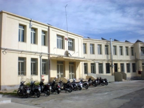
La nostra scuola - Our school

Il presente progetto è finanziato con il sostegno della Commissione europea. L’autore è il solo responsabile di questa pubblicazione (comunicazione) e la Commissione declina ogni responsabilità sull’uso che potrà essere fatto delle informazioni in essa contenute.


![Rain.2 [Francesca Boscarino]](https://live.staticflickr.com/7039/6973225399_0d584019ef_m.jpg "Rain.2 [Francesca Boscarino]")
![waves. [Domiziana Casuccio]*](https://live.staticflickr.com/7188/6956657225_fdcb9d652e_m.jpg "waves. [Domiziana Casuccio]*")
![beach.[Domiziana Casuccio]*](https://live.staticflickr.com/7044/6956656941_a192fed601_m.jpg "beach.[Domiziana Casuccio]*")
![Rough Sea. [Domiziana Casuccio]*](https://live.staticflickr.com/7056/6810544746_f5a2135c8c_m.jpg "Rough Sea. [Domiziana Casuccio]*")
![Clear sea. [Domiziana Casuccio]*](https://live.staticflickr.com/7177/6956650891_f76dc73a82_m.jpg "Clear sea. [Domiziana Casuccio]*")
![Rough Sea 2. [Domiziana Casuccio]*](https://live.staticflickr.com/7040/6810538520_b6cbf362ab_m.jpg "Rough Sea 2. [Domiziana Casuccio]*")
![Cliff. [Domiziana Casuccio]*](https://live.staticflickr.com/7208/6810535158_b1aa45308e_m.jpg "Cliff. [Domiziana Casuccio]*")

Written by francescabosk
on 28 February 2013
Leave a comment