3rd Meeting in Italy 2012 Photogallery


Water, primordial element and source of life, will find ample space in the development of Italian literature. For you today we have chosen the poem “Clear, fresh and sweet waters” by Francesco Petrarca as an example of water considered as an inspiring muse of comforting memory of the beloved woman.
According to L. Maugeri the Byzantines named the Latomy of Paradise. It is just as big as the Latomy of the Capuchins, but has a less complex structure. Located within the Latomy of Paradise there are the Ear of Dionysius and the Grotta dei Cordari (Cave of the Rope-makers). It is between 20 and 30 metres deep. Originally it must have been partly covered to protect the rock from being infiltrated with rain water which would have made it too friable, and therefore, unsuitable for construction. Naturally the covering also served another purpose; it protected the slaves who were imprisoned within. Like the Ear of Dionysius and the Cave of the Rope- makers, the Cave of the Salnitro is part of the Latomy of Paradise. It was excavated by using a particular technique where the diggers left some parts of the rock untouched, to be used as supporting pillars for the vault. Due to various collapses, caused by erosion and earthquakes, only one of these pillars remains standing, and it is known as Tower of Dionysius.
THE EAR OD DIONYSIUS
The Ear of Dionysius, is an artificial cavern excavated from the Latomy of Paradise which measures 61 metres long and 20 metres wide. It has extraordinary acoustic properties-a whisper at one end of the cavern-is perfectly audible at the other end. In 1856, Michelangelo Merisi da Caravaggio gave this cavern its name. To him we owe the legend that Dionysius tyrant of Syracuse, had it purposely excavated in order to hear the conversations of the prisoners who were imprisoned within. According to another theory, which takes into consideration the dimensions as well as the particular shape of the grotto, it was excavated to serve as a resonance box for the Greek Theatre, which was adjacent to the area.
THA CAVE OF THE ROPE-MAKERS
The Grotta dei Cordari (The Cave of the Rope-makers) is an artificial cavern about ten metres away from the Ear of Dionysius. Its ceiling rests on pillars which become thinner towards the top. These pillars demonstrate the type of excavating methods used at the inception of the latomies. This grotto, in fact, is part of the Latomy of Paradise and derives its name from the rope-makers who have used this spot for centuries. They used very primitive methods to make rope, and therefore, took advantage of the humidity of the grotto which allowed the rope to dry without shrinking when it got wet.


written by: MARIA CHIARA CASTORINA

The Roman Amphitheatre is an Imperial construction. It’s unusually big and elliptical in form. It was built between the 3rd and 4th centuries A.D. when the Romans celebrated “naumachie” (mock naval battles) and gladiatorial blood sports. Only in 1839 the Amphitheatre was excavated liberating it from the dirt, vegetation and the superimposed structures which completely covered it.
The pit has an oval form, surrounded by a high parapet. According to a very rigid subdivision of sectors and connected by series of passages, the middle and upper orders of the steps were destined to less affluent classes.
A basin was located in the centre of the arena which would be filled whit water to stage the “naumachie” games. The water flowed through and underground conduct from a Roman pool, which got its water from a spring located a little more than a kilometer of distance.
The arena had seen three constructive phases: the first dates back to the 6th century B.C, of Greek origin; the second one is from the Hellenistic-Roman period, and therefore, contemporary to the Amphitheatre: and the third is Medieval, when the Normans in the 11th century built, above it, the Church of San Nicolò dei Cordari.
< "></a
This is a presentation about the chemical composition of the water molecule. With it the students dealt with different aspects of water, for example with history of Science, talking about Cavendish and his experiment. And in Chemistry we analized the special structure of water molecule. (Click on the title link to viualize our Prezi presentation)

Brucoli is an hamlet of Augusta.
Now we are in Campolato zone, in the East of the seaside village of Brucoli, which was founded in XVI century.
In the West of Brucoli there’s the Canal, which is the mouth of the Porcaria river, named in this way because in the past pigs pastured here.
Originally the canal was called Παντακιας.
On the walls, along the canal, many caves are visible, typical houses of the Neolithic age. To the west of the canal opens a wide area, “The Gisira”.
In front of us it is possible to admire the Etna, a lot important for the Sicily and for Brucoli, too, because preannounced the weather conditions and it was a point of referent for the fishermen.
The Etna, which with its 3340 metres is the higher Vulcan in Europe,
was called “mons jebel”, that means “mount of excellence”.
All of territory of Brucoli is constitued by lime stone, except the Brucoli’s creek, where there is a clayey ground.
From the lime stone was produced the lime, which was exported by the “varchi i petra” or stone boats.
The “carcaria” was the furnace where was produced the lime.
In the low Campolato zone, named “tri puttusa”, too, is situated , where the soldiers hided themselves to avoid the disembark.
In the Campolato zone there are two trenches, too.
In this territory is a lot diffused the phenomenon of the “tonnara”, a system used for the tuna fish peach.
The killing of the tuna fish is called harpooned and the boss in named rais.
In the zone that extend between Arcile and Campolato there is a “posidoneto”, which is part of the SIC (site of interest of European Union).
The “posidonia” form the “badda i mare” or sea ball.
Now we are in “Piazza Castello”. The castle was built in XV century to defend Brucoli by the Saracens pirates.
Here there was the charger of wheat, called “la Bruca”, from this name derive the present name of the village: Brucoli.
In 1693, because of a strong earthquake , the central tower, which was more high than now , fell down and then was rebuilt.
The perimeter fence was built between in the XVI century.
• On 11th May 2012 our class went to a school trip to Brucoli with our foreign friends. They are from Estonia, Turkey, Spain and France. Before going to Brucoli we had lunch at Navy Officers’ Club. They appreciate the lunch and they like a lot Italian food. Then we arrived by coach to Campolato Zone. There we told our guests and their teacher about the place. After that we had a bath in Tri Puttusa and we had fun. Next we visited the Brucoli’s Canal and we had a tour by boat as for as the castle. Finally we had dinner at Pizzeria “Miramare.” We ate different kinds of pizza and our guests were happy. In the end we went to home. It was a fantastic experience.


Written by: Giulia Spatola and Elena Ferro
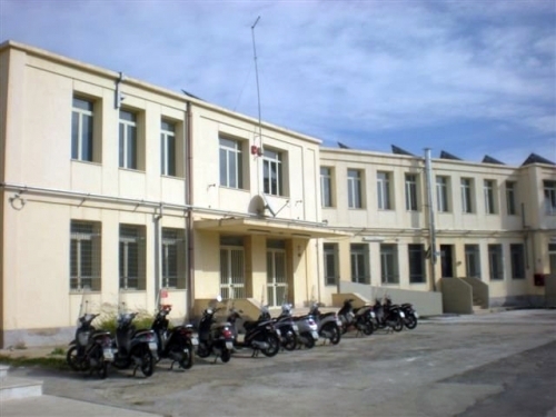
La nostra scuola - Our school

Il presente progetto è finanziato con il sostegno della Commissione europea. L’autore è il solo responsabile di questa pubblicazione (comunicazione) e la Commissione declina ogni responsabilità sull’uso che potrà essere fatto delle informazioni in essa contenute.


![Rain.2 [Francesca Boscarino]](https://live.staticflickr.com/7039/6973225399_0d584019ef_m.jpg "Rain.2 [Francesca Boscarino]")
![waves. [Domiziana Casuccio]*](https://live.staticflickr.com/7188/6956657225_fdcb9d652e_m.jpg "waves. [Domiziana Casuccio]*")
![beach.[Domiziana Casuccio]*](https://live.staticflickr.com/7044/6956656941_a192fed601_m.jpg "beach.[Domiziana Casuccio]*")
![Rough Sea. [Domiziana Casuccio]*](https://live.staticflickr.com/7056/6810544746_f5a2135c8c_m.jpg "Rough Sea. [Domiziana Casuccio]*")
![Clear sea. [Domiziana Casuccio]*](https://live.staticflickr.com/7177/6956650891_f76dc73a82_m.jpg "Clear sea. [Domiziana Casuccio]*")
![Rough Sea 2. [Domiziana Casuccio]*](https://live.staticflickr.com/7040/6810538520_b6cbf362ab_m.jpg "Rough Sea 2. [Domiziana Casuccio]*")
![Cliff. [Domiziana Casuccio]*](https://live.staticflickr.com/7208/6810535158_b1aa45308e_m.jpg "Cliff. [Domiziana Casuccio]*")

Written by francescabosk
on 24 May 2012
Leave a comment